If you like the outdoors it’s hard, nay impossible, to live in Colorado and not be swept up in the 14er season when summer comes around. I don’t consider myself a summit chaser with a list of checkboxes to tick, but somehow I ended up doing a bunch of them in my first Colorado summer. How did that happen?
One of my favorite 14er so far is Mt. Sneffels. The 14,158 feet summit towers above the rest of the Sneffels Range in the San Juan Mountains.

Taken after we got back to Ouray, CO. Hard to believe we were up there just a few hours ago.
Why Mt. Sneffels is A Favorite
Reasons why it’s my favorite is simple: The whole journey from start to finish is so much fun! The off-roading on the approach was fun, the hike was short and just a little bit technical to make it exciting, and the incredible view from the summit was the icing on the cake. It’s a high-value hike!

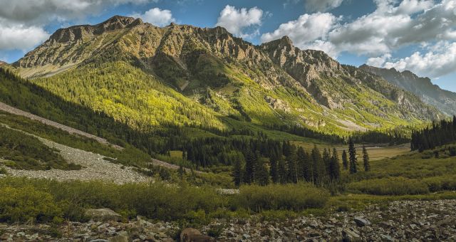
Alpenglow in the San Juan
The Approach
There are 2 possible approaches: the Blue Lakes trail near Ridgeway, and a more common one from the Yankee Boy Basin in Ouray.
The road up Yankee Boy Basin gets worse and worse as it climbs. Only 4WD vehicles with high clearance will make it to the very end. Regular cars will have to park in the lower 2WD parking lot and you’ll be looking at an 8 mile RT. The farther up the road you make it, the shorter your hike is. If you’re a lazy hiker like me, you want to go as far up the road as possible.

Early start to the summit!

At the upper trailhead. From here it’s only 1.2 miles to the summit.
We decided to rent a Jeep in Ouray and take the 4WD trail all the way to the very end. That leaves us with about 1.2 miles hike to the summit. You heard that right. 1.2 miles to summit a 14er? That’s nothing! There isn’t much hiking per-se if you can make it to this upper trailhead (12,460′). I’m more than ok with this because deep inside I’m all about instant gratification, lol.
The 4WD trail is Fun with a capital F. The last part is considered an intermediate off-road trail with big loose rocks (baby heads as someone says) and gnarly steps carved out of slippery but sharp rocks. It was a fun and thrilling ride. When I wasn’t scanning for potential tire-gashers or flips, I was enjoying the beautiful sceneries of Yankee Boy Basin. It was truly the kind where the journey is half of the fun.
The Hike
Once on the hiking trail proper, we soon came to a junction. Left fork would take us to the southwest ridge, a class 3 scramble to the summit. We turned right, heading towards the standard route or the “Lavender Couloir”. It’s named after Dwight Lavender who made the first partial ascent of the north face in 1931 (source).

Going up the loose gully up to the summit of Mt. Sneffels.
We immediately encountered a gully filled with loose gravel and dirt. Major ugh. Fortunately we were there early in the day – we were one of the first parties that summited that day – that the ground was still half-frozen. That made it much easier for us going up then those who came up later.

I love this shot that Jack took of me taking a breather while scrambling up the gully. I just happened to be in a sliver of light.

The “V” notch seen on the left of the photo encountered soon after the couloir.

Going up the gully towards the “saddle”. The route than veers left right before the saddle.

The Lavender Couloir was still covered in an icy patch (July 4th) necessitating traction and ice axes (or extra precaution).

Looking down at the Lavender Couloir.

The last scramble before the summit.
The chute, or the couloir, was still covered in late-season snow patch. Some hikers were able to navigate the snow patch by staying close to the side wall. We came prepared with ice axes and micro-spikes (only $40 and so worth it for any winter/early-season hikes), so we made easy work of the 20-30 feet of ice. We carefully navigated the airy and exposed “V” notch before a short scramble to the summit.

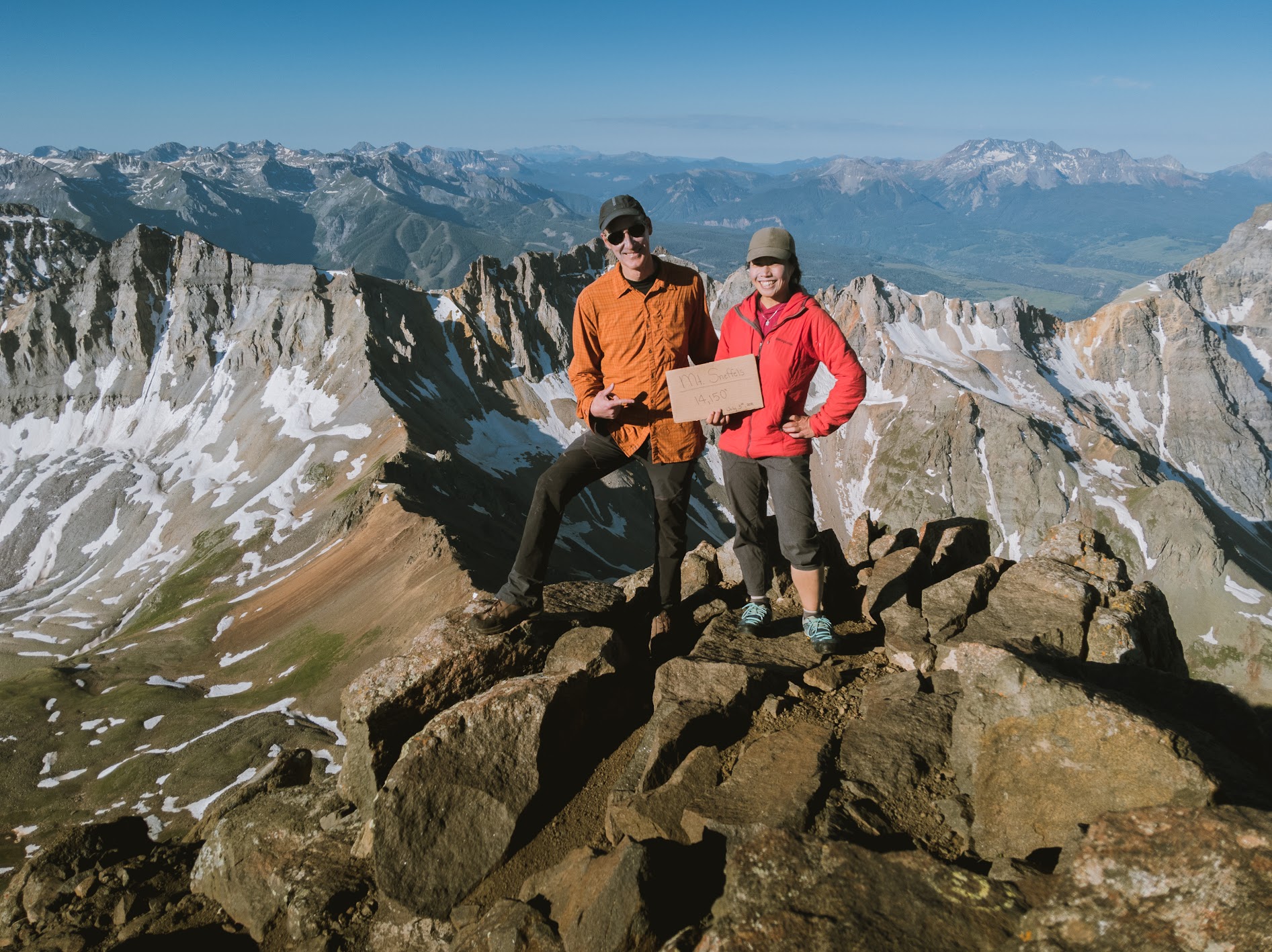
Mt. Sneffels summit pose
The Summit
The 360 degree view was incredible! There were still snow patches in the surrounding mountains even though it was July. It was so beautiful. I was very happy to be where I was.
We hung out a little bit with a couple of other groups who summited around the same time before retracing our steps.
On our way down, we saw numerous hikers approaching the summit. Those who had to hike from lower parking areas were finally here. I noticed that the scree in the gully was much looser now that the ground has thawed out. It was easy coming down – I was just sliding bringing the mountain with me. But going up was a pain.
Some hikers were having trouble making their way up the very loose sand and gravel. Some got as far as the snow patch – 100 feet below of the summit – and turned around because they weren’t comfortable going up it without tractions.
Note: micro-spikes can be used on regular hiking boots, they’re super handy and worth their price and weight. Ours is from Yaktrax.
I was thankful that we had the foresight to start early and to bring our winter gear.

Looking down the gully. You can see some hikers on the foreground while search and rescue plane going zig-zagging above us looking for the missing hiker.

Search and rescue plane
Safety in the Mountain
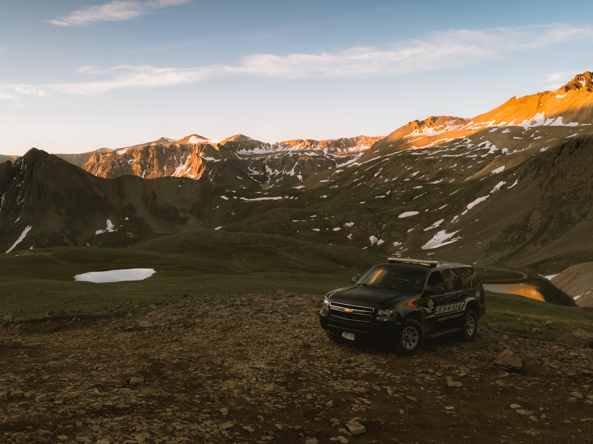
Unfortunately our success and joy was overshadowed by some sad news. While making our way up Mt. Sneffels, we were made aware that a search and rescue effort was under way. They were looking for a hiker who never made it back as scheduled the day before. We even saw a plane doing flybys to aid in the search. Back in the parking lot after finishing the hike we met a sheriff who informed us that the team wwas able to locate the missing hiker. Unfortunately he didn’t make it. He had fallen and died while descending the southwest ridge (class 3) after summiting Mt. Sneffels.
It’s a grim reminder that these activities do carry a certain risk. Tell people about your plans and be prepared to turn around if weather or a trail condition doesn’t seem right to you.
Gear and Other Info
Trailhead: Map
Recommended Gear:
- Helmet
- Ice axes – optional only if there’s still ice/snow. Check latest conditions on 14ers.com
- Micro-spikes – our Yaktrax is worth their weight and price if you do any kind of hikes in winter/early-season
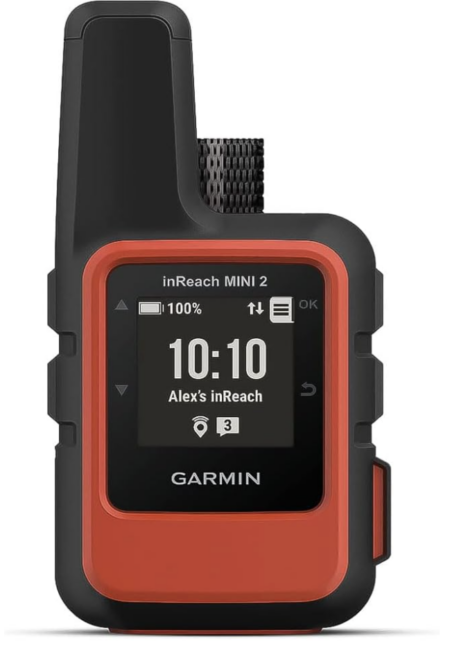
- Garmin InReach – new to our gear library. Highly recommended if you often hike solo or play in areas with no cell signals. I can’t believe we didn’t get this sooner.
- Gloves, beanies, and extra layers for warmth
Nearest Towns: Ouray or Ridgway. I wrote a guide to the area. Read it here.
—
More to read: Hiking a 14er: Mt. Sneffels, Backpacking Four Pass Loop in Aspen

Questions and Comments
Comments are disabled. If you have any questions about the post, you can DM me on Instagram: @jacknjilltravel.