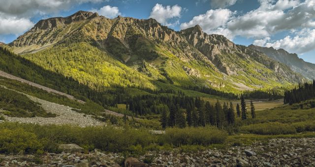
Are you looking for amazing day hikes in the Dolomites, Italy? If you love hiking, you’ll appreciate the miles and miles of hiking the Dolomites has to offer. Hiking is only one of the many outdoor adventures the Dolomites can offer, but you know… hiking is free and easy. A pair of broken-in hiking shoes, a daypack for some snacks and water bottles, and some weather appropriate clothes is just about all you’ll need to go on a day hike.
So lace up your shoes and hit the trails (also download maps.me – a free offline map we use extensively which includes the trails described below). If you’re looking for where to hike in the Dolomites, you’re in for a treat for the Dolomites is truly a hiker’s paradise.
Here are eight of the best outdoor day hikes in the Dolomites:
Cadini di Misurina
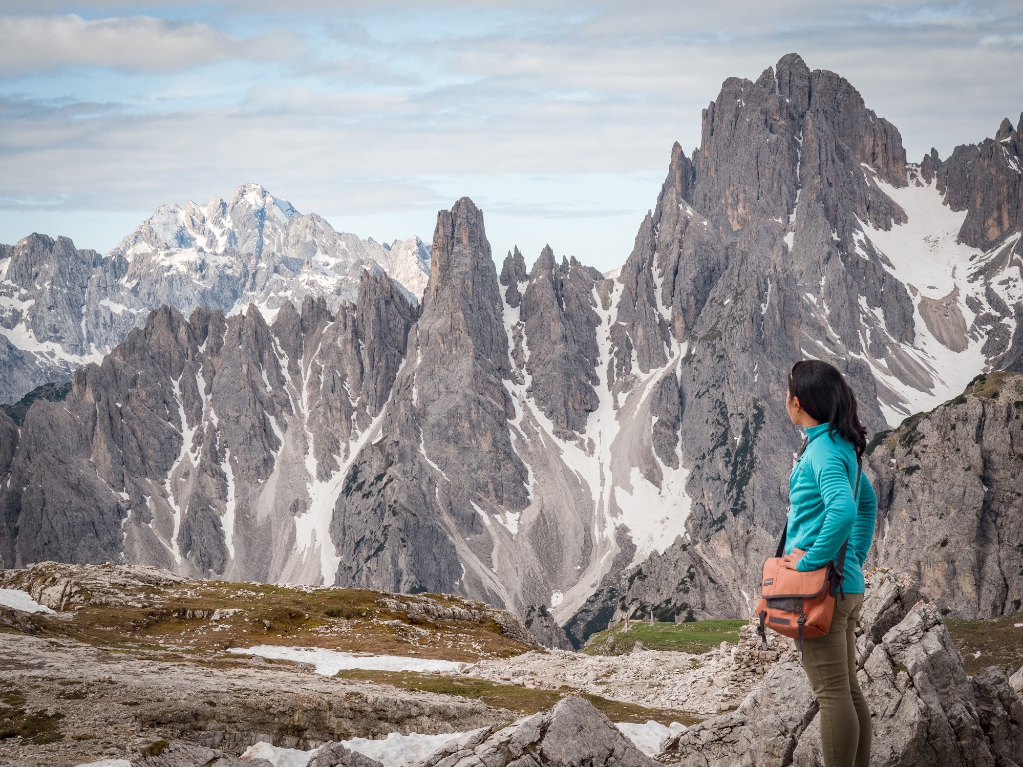
This is a short but very photogenic hike. Cadini di Misurina is a very striking formation I couldn’t take my eyes off it; a peak covered with rows of sharp pinnacles. From Rifugio Alonzo, take the obvious but un-marked trail away from Tres Cime, towards the striking Cadini di Misurina formation. You’ll know it when you see it.
We actually didn’t do this hike because we had to drive back to Trento to return the car and ran out of time. But see some examples here and here. With the promise of such scenery, I have no doubt you’ll add this to your list of day hikes to do in the Dolomites.
Tres Cime di Lavaredo Loop

Tres Cime
Tres Cime is without a doubt the most photographed landmarks of the Dolomites. Hiking here is the ultimate day hike in the Dolomites. The spectacular walk takes hikers around the magnificent formation providing vast views in all directions. You’ll pass 3 different rifugios, so there’s plenty of opportunities to eat, drink, and rest. Because of its popularity, the trail can get extremely crowded so I’d recommend getting here early (before 10am) or late in the day.
Seceda Peaks

Fermeda Peaks in Seceda
Trailhead: Ortisei. Take the cable car from Ortisei to the top. (map)
Length: Varies
Difficulty: Easy
Seceda is where Dolomite’s most striking peaks – the Fermeda peaks – are located. They’re also a lot more accessible than one would think. As soon as you get out of the cable car station, you’re like “Whoa! They’re right there!” A network of trails allows hikers to craft their own hiking itinerary in Seceda. A good possible option is to walk towards Pieralongia, a collection of boulders scattered on a grassy meadow, before looping back towards the cable car station. It’s also possible to only take the cable car one way, and descend by foot (long hike).
Catinaccio/Rosengarten
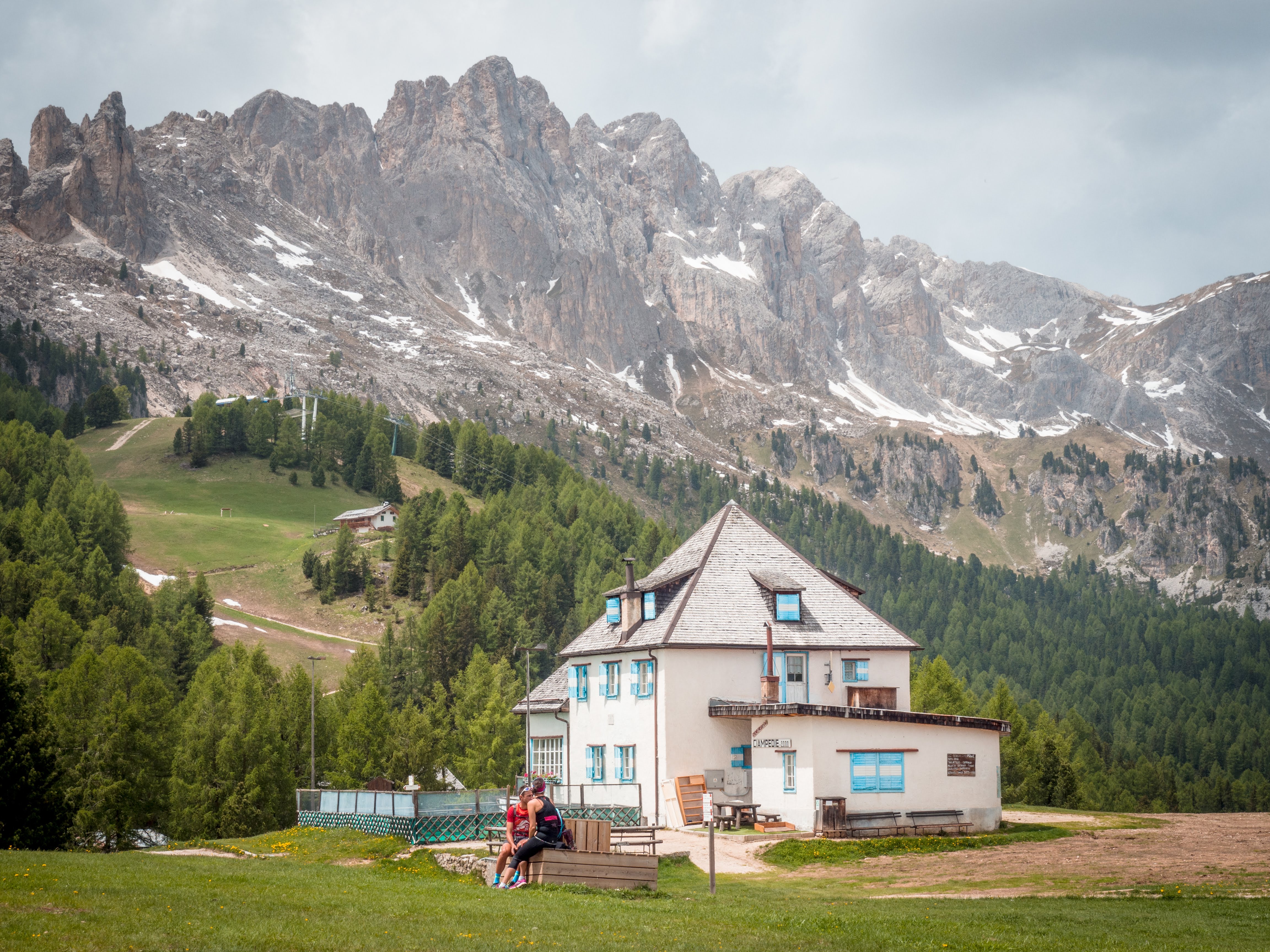
Catinaccio or Rosengarten is a UNESCO heritage site. The German name Rosengarten or “Rose Garden” comes from the pink color that the rocks take on during dawn and dusk. Catinaccio is an impressive Dolomite massif that’s worth half-a-day of exploration. The cable car from Vigo di Fassa takes you to Ciampedie, a good spot to start your hike. The view from Ciampedìe of the surrounding peaks is impressive already. The well-marked trail from Ciampedie goes through a small forest before breaking into Gardeccia basin. Here you’ll find a few restaurants surrounded by jaw-dropping grey peaks of Catinaccio.
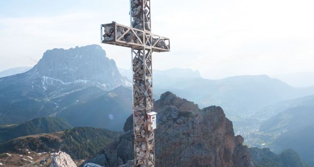
The Cross in Passo di Gardena (Gran Cir)

Val Gardena from Gran Cir hike
This hike is short, steep but extremely high value (read about the Gran Cir hike here). Your goal is the cross high up on the tallest peak. It’s visible from the road. It looks daunting and it might appear like there’s no path to get there, but there is. The trail is a little loose, steep, and exposed at some parts, but oh – it’s so rewarding. Come here for sunset and you’ll be rewarded with a 360 degree view of Dolomite ranges bathed in pastel pink, orange, and purple. Unforgettable.

- Premium efficiency and design
- Storage tuned to the each season
- Purpose designed to help mak the most of each exploration
- Stretch mesh side pocket for gear or water bottles
Dolomiti Brenta (Brentei Refugio)

Rifugio Ai Brentei
Trailhead: Refugio Vallesinella (Madonna di Campiglio) (map)
Length: 9 miles (depending on which loop)
Difficulty: Moderate
The hike is long and steep in some parts but the trail is in good condition, and the view is incredible. The hike takes you through Dolomite’s less crowded range: the Brenta. From the parking lot, you head towards Rifugio Ai Brentei. To complete a loop, you pick up the trail from the junction towards Rifugio Tuckett. From Rifugio Ai Brentei, you can keep going 2.1 miles on the trail towards Campanile Basso a striking pillar of rock.
Cinque Torri

Trailhead: Bai de Dones chairlift (map)
Length: 5 miles (loop)
Difficulty: Easy – Moderate
The loop takes hikers around the jagged rock towers of Cinque Torri. The name means 5 towers, but there are definitely more than 5 of them. The area is popular with rock climbers and you’ll no doubt see them climbing these towers. The hike also explores the remnants of WW1 trenches and barracks, that together with Lagazuoi (see hike below) form a sort of open-air museum. From the car park at lift station, you gently climb to Pian dei Menis, a minor summit, before heading left (South) following the trail to Rifugio Scoiattolli. Take a break here if you wish, and continue on to Cinque Torri proper. The main trail is clearly signed but there are plenty of detour opportunities before looping back to the car park.
Lagazuoi

View from Lagazuoi summit
Trailhead: Falzorego Pass (map)
Length: 2.5 miles (or 1.2 miles if using the cable car one way)
Difficulty: Moderate
The Lagazuoi Tunnel hike is a unique hike. You can either hike up to the summit (scree-alert!) or take a cable car (recommended). At the top, make your way to the summit proper (Lagazuoi Piccolo) for an expansive view of the surrounding mountain ranges, one of the best viewpoints in the Dolomites for sure! After enjoying the view, descend through a tunnel created during WW1. You’ll walk past storage rooms and machine gun stations, reconstructed remnants from the brutal war. The tunnel is slippery and dark, and at some parts quite steep. Make sure to wear shoes with good friction and bring a headlamp.
Related: Hiking the Lagazuoi Tunnel
—
When I was planning my Dolomites itinerary, I really wanted to optimize my time, to make sure that I picked only the best scenic hikes in the Dolomites. But after spending 3 weeks in the Dolomites, I realised that it’s really hard to go wrong here. Each hike we did was as spectacular as the one before. So I’m sure whichever day hike you choose to do, I’m sure it’ll be very scenic indeed.
For more ideas on short hikes to do in the Dolomites, I highly recommend this guide book: Shorter Walks in the Dolomites by Cicerone.

Questions and Comments
Comments are disabled. If you have any questions about the post, you can DM me on Instagram: @jacknjilltravel.